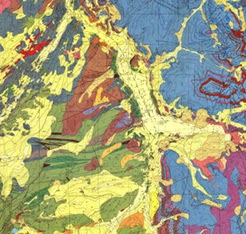
Be sure to check out the Geologic Map Day poster included in this year's Earth Science Week Toolkit at http://www.earthsciweek.org/materials/index.html.
Showing how geologic maps can be used to understand natural hazards, the poster also provides step-by-step instructions for a related classroom activity and links to state geologic maps and maps of national parks. Additional resources for learning about geologic maps can be found on the Geologic Map Day web page http://www.earthsciweek.org/geologicmap/.
"As the saying goes, 'Civilization exists by geological consent – subject to change without notice.' Outside of Alaska, California is the most seismically active state in the country, with more than 70 percent of the Nation's earthquake damage occurring in this state every year. Mapping earthquake faults and their surrounding geology is a key element in making California safer for its communities," says Dr. John Parrish, President of AASG and State Geologist
of California.
Geologic Map Day partners include the American Geosciences Institute (AGI), the Association of American State Geologists (AASG), the U.S. Geological Survey, the National Park Service, the Geological Society of America, and Esri.
To find your state's geologic survey and additional geologic mapping information go to http://www.stategeologists.org/ and click on the state of interest.
Source & Image: http://bit.ly/OALGpr


No comments:
Post a Comment